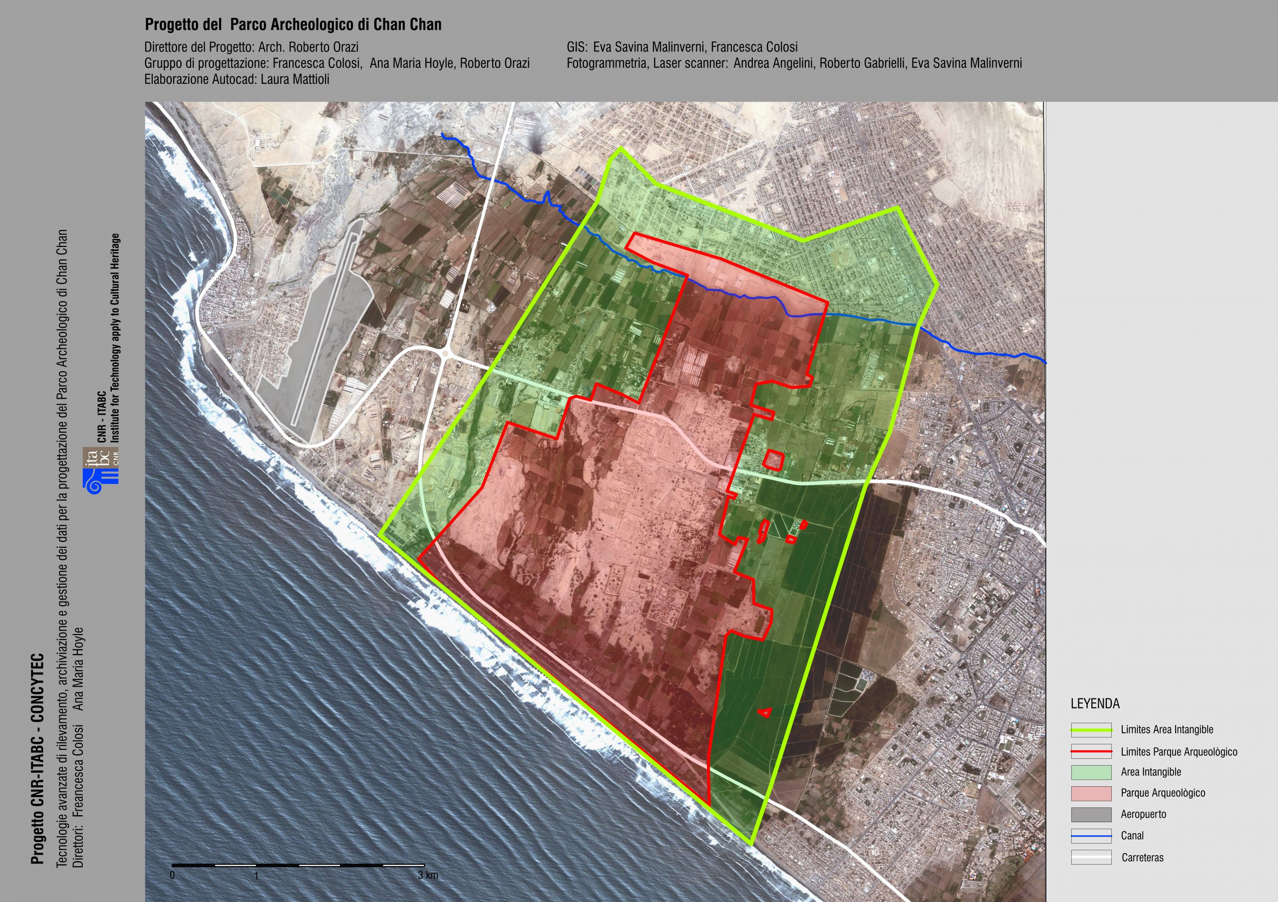
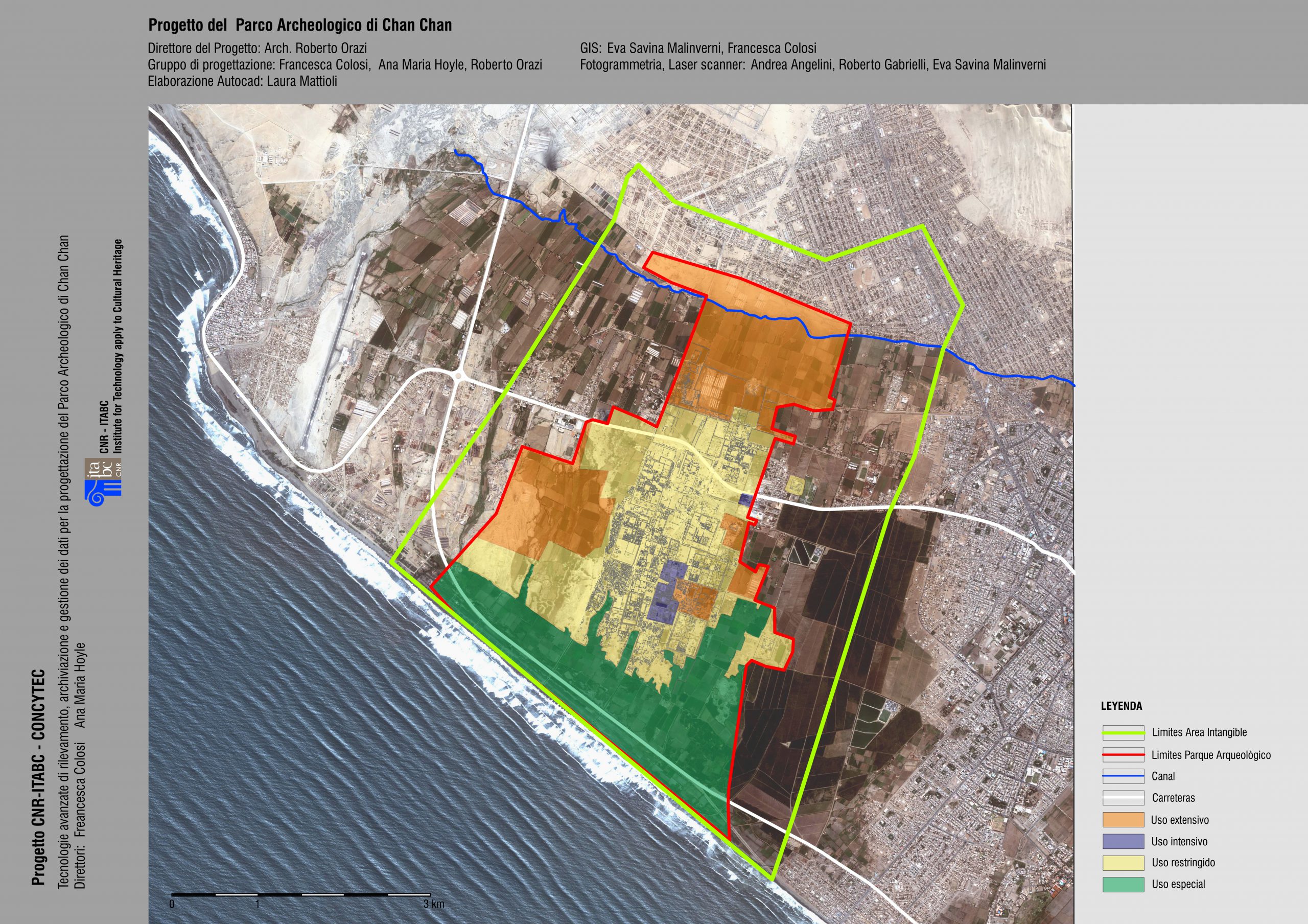
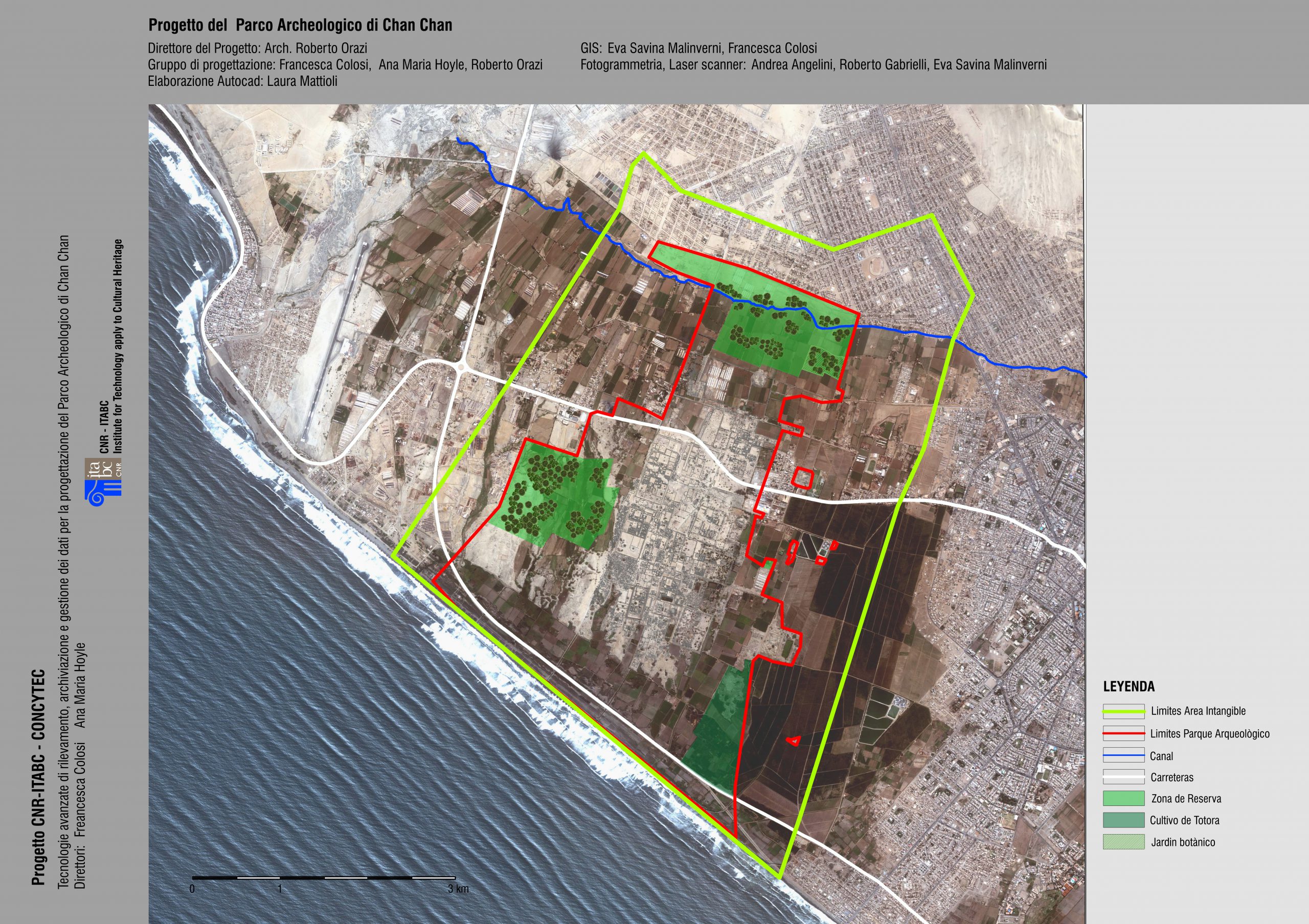
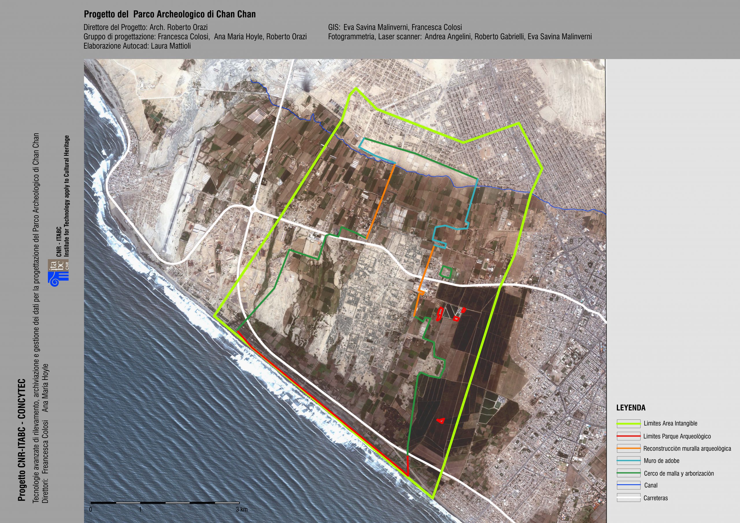
Various areas that will play particular roles in the Chan Chan Archaeological and Environmental Park have been planned. These are essentially cultural and management areas (museum and management centre), recreational areas (canals, fountains, flowerbeds, children’s games, outdoor training courses) and service areas (transport, parking, electricity cabin, waste treatment and disposal etc.).
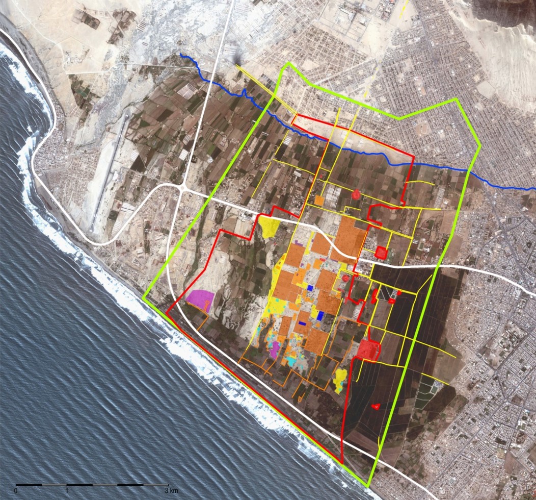
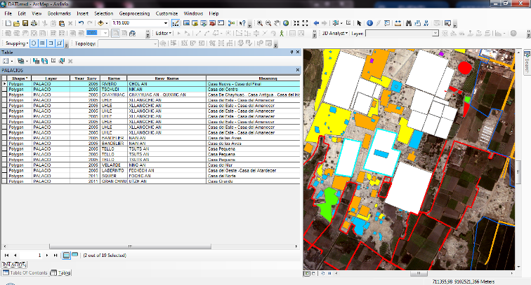
GIS MODEL OF THE ARCHAEOLOGICAL PARK
The design of the park was accompanied by detailed investigation of the surrounding territory in order to identify and interpret the residential and functional features that made up Chan Chan. Over the years, a huge amounr of information has been acquired using different survey methods: remote sensing, photogrammetry, laser scanning, GPS/GNSS and other integrated technologies. The data is managed within a specific GIS model, structured and implemented by the Italian Mission, which has been consigned to the Ministerio de Cultura. By updating it with data from recent archaeological excavations, the project (PECACH) will be able to use it as a study tool and base for management and monitoring initiatives.